Encyclopedia Dubuque
"Encyclopedia Dubuque is the online authority for all things Dubuque, written by the people who know the city best.”
Marshall Cohen—researcher and producer, CNN
Affiliated with the Local History Network of the State Historical Society of Iowa, and the Iowa Museum Association.
GREAT RIVER ROAD
GREAT RIVER ROAD. Until the early 1980s, a single Canada-to-Gulf road was eligible for special federal funding. The states along its route posted "National Route" plates above the markers on this route and marked their own alternate routes across the river, creating two alignments between New Orleans and Hastings-Point Douglas. Signs marking the National Route were later used only in Illinois and Minnesota. The National Route followed the following segments:[5]
   Venice to Port Allen, Louisiana on the west bank
   Huey P. Long Bridge
   Baton Rouge, Louisiana to Greenville, Mississippi on the east bank
   Benjamin G. Humphreys Bridge (replaced by the Greenville Bridge in 2010)
   Lake Village to West Memphis, Arkansas on the west bank
   Memphis & Arkansas Bridge
   Memphis, Tennessee through Kentucky to Chester, Illinois on the east bank
   Chester Bridge
   McBride to Hannibal, Missouri on the west bank
   Mark Twain Memorial Bridge (replaced by the modern Mark Twain Memorial Bridge in 2000)
   East Hannibal to Niota, Illinois on the east bank
   Fort Madison Toll Bridge
   Fort Madison to Muscatine, Iowa on the west bank
   Muscatine High Bridge (replaced by the Norbert F. Beckey Bridge in 1972)
   Illinois City to East Dubuque, Illinois on the east bank
   JULIEN DUBUQUE BRIDGE
   Dubuque to Lansing, Iowa on the west bank
   Black Hawk Bridge
   De Soto, Wisconsin to Point Douglas, Minnesota on the east bank (1)
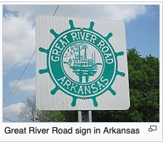
Developed in 1938, the Great River Road (GRR) follows a single route from Point Douglas north to Lake Itasca tracing the course of the Mississippi River passing Minnesota, Wisconsin, Iowa, Illinois, Missouri, Kentucky, Tennessee, Arkansas, Mississippi and Louisiana. It formerly extended north into Canada, serving the provinces of Ontario and Manitoba. The 2,340 miles (3,765 km) of roadway are designated with a green-and-white sign showing a river steamboat inside a pilot wheel with the name of the state or province.
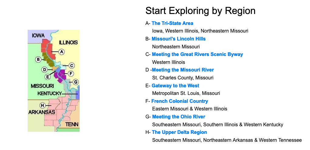
Much of the area of the Great River Road was later designated a National Scenic Byway. The GRR also includes the Meeting of the Great Rivers Scenic Byway Area where the Mississippi, Missouri, and Illinois Rivers meet. As indicated on the map, other regions exist. (2)
---
Source:
1. "Great River Road," Wikipedia. https://en.wikipedia.org/wiki/Great_River_Road
2. "Welcome to the Middle Mississippi River Valley" Online: https://www.greatriverroad.com/


