Encyclopedia Dubuque
"Encyclopedia Dubuque is the online authority for all things Dubuque, written by the people who know the city best.”
Marshall Cohen—researcher and producer, CNN
Affiliated with the Local History Network of the State Historical Society of Iowa, and the Iowa Museum Association.
STREETS: Difference between revisions
No edit summary |
(I added a lot of content from resources Carnegie-Stout's Dubuque vertical file and made a few minor corrections and format changes.) |
||
| Line 224: | Line 224: | ||
Reed Avenue------------------Marshall Street------------------1921 | Reed Avenue------------------Marshall Street------------------1921 | ||
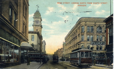
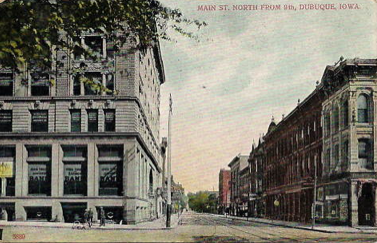
[[Image:mainnfrom9.png|right|thumb|250px|A postcard with an interesting viewpoint of Main north from 9th]] | |||
Riga Street----------------------------Algona Street------------------1921 | Riga Street----------------------------Algona Street------------------1921 | ||
| Line 264: | Line 266: | ||
Wartburg Avenue--------------------Fremont Avenue--------------------1920 | Wartburg Avenue--------------------Fremont Avenue--------------------1920 | ||
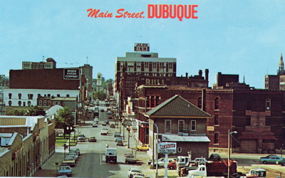
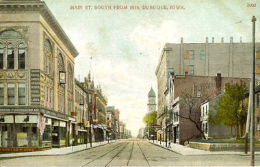
[[Image:mainsfrom10.png|right|thumb|250px|A postcard a viewpoint of Main south from 10th. Photo courtesy: Bob Reding]] | |||
Washington Street----------------O'Hagen Street | Washington Street----------------O'Hagen Street | ||
| Line 292: | Line 296: | ||
4th Avenue--------------------------Emerson--------------------1921 | 4th Avenue--------------------------Emerson--------------------1921 | ||
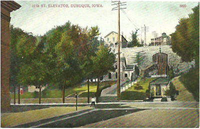
[[Image:11th1910.png|right|thumb|250px|1910 view of West 11th Street and its elevator.]] | |||
5th Avenue (west of Linwood Cemetery)--------Edith Street-------------------------1921 | 5th Avenue (west of Linwood Cemetery)--------Edith Street-------------------------1921 | ||
| Line 310: | Line 316: | ||
The name Whiskey Hill was used colloquially to refer to Southern Avenue through the late 19th and early 20th centuries, but never appeared on any printed map or street sign. | The name Whiskey Hill was used colloquially to refer to Southern Avenue through the late 19th and early 20th centuries, but never appeared on any printed map or street sign. | ||
---- | |||
--- | |||
'''Sources''' | '''Sources''' | ||
*Lorimer Avenue." <u>Dubuque Times Journal</u> | *Lorimer Avenue." <u>Dubuque Times Journal</u>. Dubuque, IA, May 4, 1858. | ||
*"Ordinance Changing Street Names is Passed by Council at Last Meeting." <u>Dubuque Times Journal</u>, Dubuque, IA, March 27, 1921. | *"Ordinance Changing Street Names is Passed by Council at Last Meeting." <u>Dubuque Times Journal</u>, Dubuque, IA, March 27, 1921. | ||
Revision as of 22:39, 4 April 2011
STREETS (name changes). Dubuque, like other Iowa cities, changed street names over the years. Many changes were made in 1921 at the suggestion of CARR, Ossian E., Dubuque's first City Manager. Among those that have been changed are the following:
Original Name-------------------Present-------------------Date of Change
Adams Avenue-------------------Prescott Street-------------------1921
Adams Street---------------------Sac Street----------------------1921
Alma Street-----------------------Montrose
Altman Avenue-----------------St. Joseph Street------------------1921
Anne Place----------------------West 18th Street
Arch Street--------------------Seminary Street-------------------1921
Aspen-------------------------------Linden
Audubon---------------------------Grandview
Austin Place----------------------Raymond Place
Blocklinger Lane----------------West 24th Street-----------------1921
Bluff Street-----------------------Providence
Bluff------------------------------High Bluff
Boundary Street------------------Grandview Avenue----------------1871
Brad Street--------------------------Booth
Broad Street----------------------Mt. Pleasant
Brugh-------------------------------Schiller
Cardiff Street-------------------Summit Street-------------------1921
Cascade Road------------------------Fremont
Centre Street-----------------------Asbury
Center Street---------------------Finley Street------------------1921
Clay Street---------------Central Avenue (1st to 18th)-----------1921
Clifford Street-------------------Eighth Street------------------1921
Clifford---------------------------Foye Street
Clifton Street-------------------Altman Avenue-------------------1921
Columbia---------------------------Lexington
Cora Street----------------------South Hill St.
Couler Street--------Central Avenue (18th to city limits)--------1921
Delhi Street--------------------University Avenue----------------1921
Division------------------------------Lincoln
Dubuque Street------------------------Sumner
Eagle Point Street---------------------20th
Eagle Street Extension-----------Lindberg Terrace
East Street----------------------McCormick Street----------------1921
East--------------------------------Glen Oak
Eleanor Street---------------------Indian Ridge
Edith Street----------------------Roland Street------------------1921
Empley's Lane---------------------Thomas Street------------------1921
Exchange Street--------------------South Hill
Fink Street-----------------------Jansen Street------------------1921
Forrest Street-----------------------Florence
Franklin Street------------------West 16th Street----------------1921
Franklin------------------------------Fulton
Franklin------------------------------Edison
Fremont Avenue--------------------Wartburg Avenue-------------------- circa 1889
Fremont Avenue-------------------Wartburg Place------------------1921
Front Street-------------------------Peosta----------------------1938
Grandview Heights---------------Plymouth Court
Grant Avenue----------------------Wilson Street------------------1921
Grove Street---------------------Greeley Street------------------1921
Hales Mill---------------------------Asbury
Hall Street----------------------Auburn Street-------------------1921
Harrison-----------------------------Monroe
Hart Street--------------------------West 23rd-------------------1921
Hazel Street------------------------Sunnyview
Herron Street------------------South Locust Street---------------1921
High Street-------------------------Rhomberg
High Street-------------------------Highland Pl.
Iowa Street Extension-------------Shelby Street
James Street-----------------------Huff
Jefferson Avenue-----------------Carter Road
John Street-------------------------Simpson
Julien Avenue--------------------Lorimer Avenue------------------1858
Julien Avenue-------------------University Avenue----------------1940
Julien--------------------------------Primrose
Karrick Street---------------------Finley Street-----------------1921
Klingenberg Street---------------Hennepin Street-----------------1921
Lake Street-------------------------Garfield
Leibnitz Street------------------Lowell Street-------------------1921
Lemon-------------------------------Viola
Lenox Avenue---------------------Van Buren
Linden Blvd------------------------Logan Street------------------1921
Logan-------------------------------Belmont
Lorimier Avenue-----------------Julien Avenue-------------------1859
Louisa Street----------------------Algona Street------------------1921
Main Street------------------------Front Street
Malady------------------------------South Booth
Maple Street-----------------------Morton Street----------------1921
Martha Ann------------------------Martha
McCabe----------------------------Broadway
Middle Avenue---------------------Farley Street----------------1921
Mineral Street--------------------West Locust
Millville Street--------------------32nd Street----------------1921
Military Street---------------------Rockdale Road
Monroe-----------------------------Harlan
Mount Carmel Avenue-------------South Locust Street--------------1921
National Street-------------------Delhi
North Cascade Road----------------Fremont Avenue----------------1921
North Street-----------------------Hale----------------1921
North 1st Street------------------Kimball Street------------------1921
North Iowa Street---------------Shelby Street
North Main Street------------------Main Street------------------1921
O'Neill Street---------------------Langworthy------------------1921
Orange----------------------------Washington
Park Avenue------------------Randall Place------------------1921
Park Street------------------------Asbury Road
Park Hill---------------------------West 28th------------------1921
Park Way Avenue------------------Park Street------------------1921
Peru Road------------------32nd Street------------------1921
Pine Street------------------------Caledonia
Pine Street------------------------Pinard
Pine Street------------------Poe Street------------------1921
Planke Road----------------------Couler
Pleasant View Avenue------------------Lexington Street------------------1921
Rebecca Street-------------------Fairview Place
Reed Avenue------------------Marshall Street------------------1921
Riga Street----------------------------Algona Street------------------1921
Rosedale Avenue------------------Auburn Street------------------1921
Russell Street------------------Rowan Street------------------1921
Sanford Street---------------------East 24th------------------1921
Seminary Street-------------------Clarke Drive
Seminary Street (from 17th to 18th)----Heeb Street------------------1921
South Dodge Street----------------------Bryant Street------------------1921
South Street-----------------------Lombard
Spring------------------------------North Booth
State--------------------------------National
Stewart Street---------------------Southern
Thomas Street--------------------West 16th Street--------------------1921
Union Avenue---------------------Kirkwood Street--------------------1921
Valley-------------------------------Dillon Street
Vine Street--------------------Burns Street--------------------1921
Walnut------------------------------Karrick
Wall---------------------------------Wallace
Wabash Avenue-------------------------Seward Street--------------------1921
Warren-------------------------------Putnam
Wartburg Avenue--------------------Fremont Avenue--------------------1920
Washington Street----------------O'Hagen Street
West Street-------------------------Needham Place
West 4th Street--------------------Melrose Street--------------------1921
West 14th Street--------------------Loras Avenue--------------------1940
West Main Street---------------------------Shields Street--------------------1921
West Eagle Point Avenue-----------Kaufmann
West Seminary--------------------Ungs Street
Whelan------------------------------Bradley
Wilde Street------------------------Mt. Loretta
Willow-------------------------------Rosedale Street--------------------1921
1st Avenue---------------------------Decatur--------------------1921
2nd Avenue--------------------------Hamilton--------------------1921
3rd Avenue--------------------------Whittier--------------------1921
4th Avenue--------------------------Emerson--------------------1921
5th Avenue (west of Linwood Cemetery)--------Edith Street-------------------------1921
5th Avenue (east of Linwood Cemetery)--------Roosevelt Street---------------------1921
6th Avenue--------------------------Stanton--------------------1921
7th Avenue--------------------------Shiras Avenue--------------------1921
8th Avenue--------------------------Farragut--------------------1921
9th Avenue--------------------------Hawthorne--------------------1921
10th Avenue-------------------------Sumner--------------------1921
The name Whiskey Hill was used colloquially to refer to Southern Avenue through the late 19th and early 20th centuries, but never appeared on any printed map or street sign.
Sources
- Lorimer Avenue." Dubuque Times Journal. Dubuque, IA, May 4, 1858.
- "Ordinance Changing Street Names is Passed by Council at Last Meeting." Dubuque Times Journal, Dubuque, IA, March 27, 1921.
- Research by John Klauer; 1918 Dubuque City Directory
- Stessman, James T. "History of the Names of Streets of Dubuque." April 26, 1954. On file at Carnegie-Stout Public Library.
- "Whiskey Label Sticks to Steep Hill." Telegraph Herald, Dubuque, IA, March 16, 1999.


