Encyclopedia Dubuque
"Encyclopedia Dubuque is the online authority for all things Dubuque, written by the people who know the city best.”
Marshall Cohen—researcher and producer, CNN
Affiliated with the Local History Network of the State Historical Society of Iowa, and the Iowa Museum Association.
STREETS: Difference between revisions
No edit summary |
No edit summary |
||
| Line 36: | Line 36: | ||
1856--1878---from Ellis west on the Bluffs, first street north of Mineral | 1856--1878---from Ellis west on the Bluffs, first street north of Mineral | ||
1880--from Ellis west, first street north of West Locust | |||
------------ | ------------ | ||
| Line 46: | Line 48: | ||
1870--1878---Third north to Julien Avenue, first west of Pine | 1870--1878---Third north to Julien Avenue, first west of Pine | ||
1880--from Julien south to West Third, first west of Wilson | |||
------------ | ------------ | ||
Alpine | |||
1880--from Dodge north, first east of Brad | |||
--- | |||
Alta Vista | Alta Vista | ||
| Line 56: | Line 66: | ||
1870--1878---Julien north beyond 14th, first east of Spring | 1870--1878---Julien north beyond 14th, first east of Spring | ||
1880---from Julien Avenue north to West Locust, first west of Center Place | |||
------------ | ------------ | ||
Alva | |||
1880--from Ascension to Range, first west of George | |||
--- | |||
Angela | |||
1880---from West Locust south, first west of Clark | |||
--- | |||
Ann | Ann | ||
| Line 64: | Line 88: | ||
1867---third street south of 1st; Eagle Point | 1867---third street south of 1st; Eagle Point | ||
1880--Division to Peosta, first north of Fengler | |||
------------ | ------------ | ||
Apple | |||
1880--Rush to Oak, first west of Pear | |||
--- | |||
Arch | Arch | ||
| Line 72: | Line 104: | ||
1867--1878---fourth street north of Delhi; West Dubuque | 1867--1878---fourth street north of Delhi; West Dubuque | ||
1880---West Locust west to city limits, first north of Willow | |||
----- | ----- | ||
| Line 78: | Line 112: | ||
1875--1878---Grove west to Prairie | 1875--1878---Grove west to Prairie | ||
1880---Grove west to Prairie, first south of West 14th | |||
------ | ------ | ||
Ascension | |||
1880---from Range east | |||
--- | |||
Ash | Ash | ||
| Line 87: | Line 129: | ||
1867---twelfth street east of Main | 1867---twelfth street east of Main | ||
1870-- | 1870--1880---12th north to Peosta, twelfth east of Main | ||
------------ | ------------ | ||
| Line 94: | Line 136: | ||
1858--1865---20th to Peosta | 1858--1865---20th to Peosta | ||
1880--20th to Peosta, sixteenth east of Main | |||
----- | ----- | ||
Aspen | |||
1880--from Valley south | |||
---- | |||
Atlantic | |||
1880--from Fremont to Clinton, first north of Lull | |||
Bee Branch Road | Bee Branch Road | ||
| Line 102: | Line 156: | ||
----- | ----- | ||
Augusta | |||
1880--from Peabody Avenue to Clara, first east of Silver | |||
--- | |||
Avon | |||
1880--west from alley west of High, first south of Chestnut | |||
--- | |||
Bell | |||
1880--from 8th to alley south of 6th, first west of Tower | |||
--- | |||
Belle | |||
1880--Dodge to Grand View, first east of South Dodge | |||
--- | |||
Bellevue | |||
1880--from Alta Vista to Union Avenue, first south of William | |||
--- | |||
Birch | Birch | ||
1858--1873---20th to Peosta | 1858--1873---20th to Peosta | ||
1880---19th to Peosta, fifteenth east of Main | |||
----- | ----- | ||
Blake | |||
1880--from West Locust south, first east of Alta Vista | |||
--- | |||
Blake's Hollow | Blake's Hollow | ||
| Line 118: | Line 210: | ||
1867---from Couler Avenue, west to Broadway | 1867---from Couler Avenue, west to Broadway | ||
1880--Blocklinger Lane from Couler to Broadway, first south of Diagonal | |||
----- | ----- | ||
Bluff | Bluff | ||
1856---second street west of Main | 1856---second street west of Main | ||
| Line 128: | Line 222: | ||
1870--1878---Dodge north to Mineral, second west of Main | 1870--1878---Dodge north to Mineral, second west of Main | ||
1880---Villa to 16th, second west of Main | |||
------------- | ------------- | ||
Bluff (Ham's Addition) | |||
1880---from 5th to south of 1st, first west of Division | |||
--- | |||
Bluff (Cook's Addition) | |||
1880---from Johnson to Stafford, first west of Division | |||
--- | |||
Boundary | Boundary | ||
| Line 142: | Line 250: | ||
1875--1878---West Fifth north to Julien, first west of Nevada | 1875--1878---West Fifth north to Julien, first west of Nevada | ||
1880---Julien Avenue to Dodge, first west of Nevada | |||
----- | ----- | ||
| Line 156: | Line 266: | ||
1873---Julien Avenue to Third, to the suburbs | 1873---Julien Avenue to Third, to the suburbs | ||
1880---Julien Avenue forth, first west of East | |||
------------- | ------------- | ||
| Line 164: | Line 276: | ||
1870--1878---Sanford north to Diagonal, first west of Couler | 1870--1878---Sanford north to Diagonal, first west of Couler | ||
1880---north of King to Blocklinger Lane, first west of Couler | |||
------------------ | ------------------ | ||
Burch | |||
1880---West 5th to West 3rd, first west of Summit | |||
--- | |||
Burlington | Burlington | ||
| Line 172: | Line 292: | ||
1867---third street south of Dubuque | 1867---third street south of Dubuque | ||
1880---from west of State to Sabula, first south Muscatine | |||
------------- | ------------- | ||
Bush | |||
1880---from west of St. George, to Esther, first south of Wilde | |||
--- | |||
Byron | Byron | ||
| Line 195: | Line 323: | ||
1858--1873---Harbor Company's levee to Locust | 1858--1873---Harbor Company's levee to Locust | ||
1880---West Main to Levee, first north of Railroad Avenue | |||
--------- | --------- | ||
Canal | |||
1880---Iowa to Water, first north of Jones | |||
--- | |||
Cannon | |||
1880---Clark to Lawther, first north of Burden | |||
--- | |||
Cardiff | |||
1857--1873---from 3rd on the Bluff south | 1857--1873---from 3rd on the Bluff south | ||
| Line 205: | Line 347: | ||
1875--1878---West Third, south | 1875--1878---West Third, south | ||
1880---West Third south, first west of St. Mary's | |||
---------------- | ---------------- | ||
Catherine | |||
1880---from Harriet Avenue to Wabasha Avenue, first north of Quincey | |||
---- | |||
Catherine | |||
1880---north from 17th, first west of West Locust | |||
---- | |||
Cave | |||
1880---from east of Lemon to Delhi, first north of Julien | |||
--- | |||
Cedar | Cedar | ||
| Line 215: | Line 377: | ||
1870--1878---10th to 19th, ninth east of Main | 1870--1878---10th to 19th, ninth east of Main | ||
1880---10th to Lake, ninth east of Main | |||
------------- | ------------- | ||
Cedar | |||
1880---17th to alley south of 6th | |||
--- | |||
Centre No. 1 | Centre No. 1 | ||
Revision as of 20:22, 6 June 2015
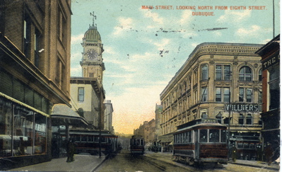
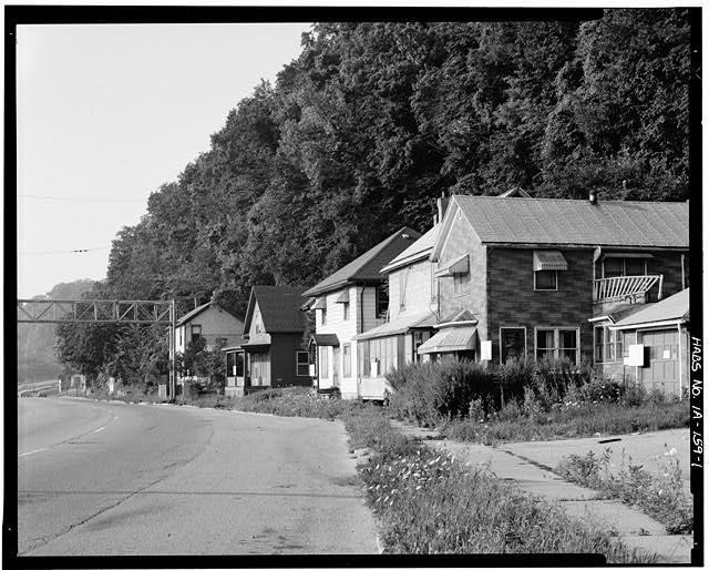
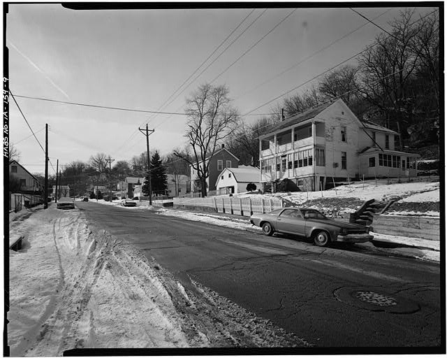
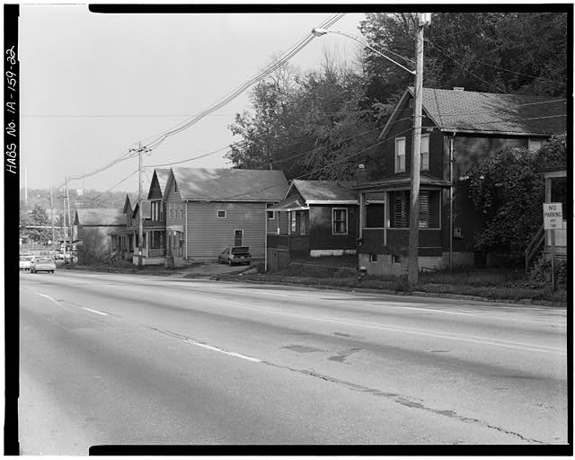
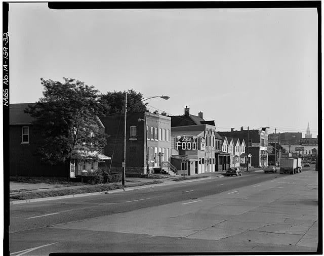
STREETS. The congressional act of July 2, 1836 provided for surveying the lots and streets of several area cities including Dubuque. A total of $3,000 was appropriated to cover the expense. On March 3, 1837, an amendatory act was passed by which three commissioners were appointed to hear all evidence under the claims. These commissioners were to be paid six dollars per day.
Surveying streets did not suggest the early settlers wanted to quickly improve this means of transportation.
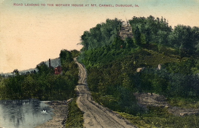
         Indian trails and miners' paths there were through
         Dirty Hollow,over Whisky and Hamilton hills, through
         the tortuous windings of Madden hollow, over the
         rugged ascent of Lorimier Hollow, now Julien Avenue,
         and through several other wild ravines and over the
         craggy steeps of the bluffs around the city. The only
         unobstructed approach to the city was by way of what
         is called the Couler at the upper end of town. Farmers,
         of course, complained, but their complaints were for
         some time unheeded. They had to watch the opportunity
         of fair weather to come to town and wait for each other
         at the foot of the hills to double and sometimes treble
         teams to help each other through. This process went on
         for years until other markets superseded this largely.
         Galena enterprise put a ferry across the river at Tete
         des Mortes and secured much of the trade of Jackson and
         southern Dubuque counties. Other points — Bellevue,
         Muscatine and Davenport — drew from the county west.
         It was then realized that Dubuque would have to improve its
         Indian trails and miners' paths."
                (Express and Herald, October 24, 1855.)
The following are the names and locations of streets listed in the local directory.
Air Hill
1856--1878---from 8th to Julien Avenue on the Bluffs
Almond
1856--1878---from Ellis west on the Bluffs, first street north of Mineral
1880--from Ellis west, first street north of West Locust
Alpine
1856--1865---from Third to Julien Avenue on the Bluffs
1867---second street east of Spring
1870--1878---Third north to Julien Avenue, first west of Pine
1880--from Julien south to West Third, first west of Wilson
Alpine
1880--from Dodge north, first east of Brad
---
Alta Vista
1856---from Third to Julien Avenue on the Bluffs
1857--1873---from Julien Avenue to Mineral
1870--1878---Julien north beyond 14th, first east of Spring
1880---from Julien Avenue north to West Locust, first west of Center Place
Alva
1880--from Ascension to Range, first west of George
---
Angela
1880---from West Locust south, first west of Clark
---
Ann
1856--1878---from Division to Peosta
1867---third street south of 1st; Eagle Point
1880--Division to Peosta, first north of Fengler
Apple
1880--Rush to Oak, first west of Pear
---
Arch
1857--1873---from Centre No. 1 each way; West Dubuque
1867--1878---fourth street north of Delhi; West Dubuque
1880---West Locust west to city limits, first north of Willow
Arlington
1875--1878---Grove west to Prairie
1880---Grove west to Prairie, first south of West 14th
Ascension
1880---from Range east
---
Ash
1856--1873---from the MISSISSIPPI RIVER to Peosta
1867---twelfth street east of Main
1870--1880---12th north to Peosta, twelfth east of Main
Aspen
1858--1865---20th to Peosta
1880--20th to Peosta, sixteenth east of Main
Aspen
1880--from Valley south
Atlantic
1880--from Fremont to Clinton, first north of Lull
Bee Branch Road
1867---twenty-ninth street north of Jones
Augusta
1880--from Peabody Avenue to Clara, first east of Silver
---
Avon
1880--west from alley west of High, first south of Chestnut
---
Bell
1880--from 8th to alley south of 6th, first west of Tower
---
Belle
1880--Dodge to Grand View, first east of South Dodge
---
Bellevue
1880--from Alta Vista to Union Avenue, first south of William
---
Birch
1858--1873---20th to Peosta
1880---19th to Peosta, fifteenth east of Main
Blake
1880--from West Locust south, first east of Alta Vista
---
Blake's Hollow
1867---south side of Mineral, west of Bluff
Blocklinger's Alley
1867---from Couler Avenue, west to Broadway
1880--Blocklinger Lane from Couler to Broadway, first south of Diagonal
Bluff
1856---second street west of Main
1857--1873---from Dodge to Mineral at Fifteenth
1870--1878---Dodge north to Mineral, second west of Main
1880---Villa to 16th, second west of Main
Bluff (Ham's Addition)
1880---from 5th to south of 1st, first west of Division
---
Bluff (Cook's Addition)
1880---from Johnson to Stafford, first west of Division
---
Boundary
1867---from Julien Avenue, south across Dodge to South Avenue
Brad
1870---5th north to Mineral, second west of Main
1875--1878---West Fifth north to Julien, first west of Nevada
1880---Julien Avenue to Dodge, first west of Nevada
Broad
1856---from Julien Avenue to 14th on the Bluffs
1857--1867---from Julien Avenue on the Bluffs to suburbs
1867---second street west of Spring
1870--1878---Julien Avenue north, fourth west of Alta Vista
1873---Julien Avenue to Third, to the suburbs
1880---Julien Avenue forth, first west of East
Broadway
1856--1873---from Sanford to Diagonal
1870--1878---Sanford north to Diagonal, first west of Couler
1880---north of King to Blocklinger Lane, first west of Couler
Burch
1880---West 5th to West 3rd, first west of Summit
---
Burlington
1857--1873---from Sabula N. W. to suburbs
1867---third street south of Dubuque
1880---from west of State to Sabula, first south Muscatine
Bush
1880---from west of St. George, to Esther, first south of Wilde
---
Byron
1857--1873---from Dubuque and Millville Road north
1867---from Bee Branch road north crossing Shelly
1878---from Dubuque and Bellevue road
Camanche
1857--1873---from Park Hill to Dubuque
Camp
1858--1873---Harbor Company's levee to Locust
1880---West Main to Levee, first north of Railroad Avenue
Canal
1880---Iowa to Water, first north of Jones
---
Cannon
1880---Clark to Lawther, first north of Burden
---
Cardiff
1857--1873---from 3rd on the Bluff south
1870---3rd south
1875--1878---West Third, south
1880---West Third south, first west of St. Mary's
Catherine
1880---from Harriet Avenue to Wabasha Avenue, first north of Quincey
Catherine
1880---north from 17th, first west of West Locust
Cave
1880---from east of Lemon to Delhi, first north of Julien
---
Cedar
1856--1873---from 10th to 19th
1867---ninth street east of Main
1870--1878---10th to 19th, ninth east of Main
1880---10th to Lake, ninth east of Main
Cedar
1880---17th to alley south of 6th
---
Centre No. 1
1857--1873---from Julien Avenue to Corporation Line; West Dubuque
1867---from Delhi north; West Dubuque
Centre No. 2
1857--1873---from Delhi south; West Dubuque
1870--1878---Center (change of spelling), Delhi south
Charles
1857--1873---from McCabe west
1867---from head of Diagonal west
1870--1878---crosses Muscatine to McCabe
Charter
1858--1873---from Harbor Company's levee to Locust
Cherry
1857--1873---from Centre No. 1 each way; West Dubuque
1867---first street north of Delhi; West Dubuque
1870--1878---west city limits, east
Chestnut
1870---Grove west, second north of Julien Avenue
Clark
1875--1878---Grove west, second north of Julien Avenue
Clay
1856---from Levee to Eighteenth
1857--1873---from 7th to 18th
1865--1870---from 3rd to 18th, second east of Main
1875--1878---first north of 18th, second east of Main
Commercial
1857--1873---Commercial---from 7th Street bridge to main river
Couler Avenue
1856--1873---from 18th to Peru Road
1867---west of Clay, from 18th north
1870--1878---18th north to northwest city limits
Davenport
1857--1878---from Park Hill N.W. to suburbs
1867---first street south of Dubuque
Delhi
1857--1873---from Julien Avenue to Centre No. 1 to Corporation Line; West Dubuque
1867--1878---from Julien Avenue west; West Dubuque
Diagonal
1856--1873---from Couler Avenue to McCabe
1867---north of 22nd, from Couler Avenue, west
1870--1878---Couler Avenue west to Charles
Division
1857--1873---from Johnson Avenue to Eagle Point
1867--1878---from Johnson Avenue, northeast to city limits
Dock
1856--1878---from Peosta to Division
1867---second street south of First;Eagle Point
Dodge
1856--1873---from MISSISSIPPI RIVER to summit on the Bluffs
1867---first street south of Jones
1870--1878---Main west to city limits, first south of Jones
Dubuque
1857--1873---from Camanche N.W. to suburbs
1867--1878---west of Couler Avenue, from Park Hill Avenue north
Eagle Point Avenue
1857--1865---from Couler Avenue east and west indefinitely
1867---twenty-first street north of Jones
1870--1878---Washington, west to west city limits, first north of Lake
Eagle Point Levee
1857--1873---lies along the river shore at Eagle Point, length undefined
1867---northern part of city
East
1856---from Julien Avenue to 14th
1857--1865---from Julien Avenue to suburbs
1867---first street west of Spring
1870--1878---Julien Avenue north, third west of Alta Vista
Ellis
1857--1873---from Mineral north
1867---west of Main, from Mineral north
1875--1878---Mineral north to Almond
Elm
1856--1878---from 10th to 19th
1867---sixth street east of Main
Fenelon
1857---from Prospect to Cardiff on the Bluffs between 3rd and 5th streets
1858--1873---Prospect to Old Corporation Line on the Bluffs between 3rd and 5th streets
1867---north of Third, crossing Summit
1875--1878---Summit east to near Bluff
Finley
1857---first street west of Centre; West Dubuque
1858--1873---from Delhi across Green; West Dubuque
1867---first street west of Centre; West Dubuque
1875--1878---first west of Center
Forest Lane
1857--1873---from Nevada west
1867---south of Julien Avenue, from Alpine, west
Fulton
1867---third street west of Bluff, from Eleventh, north
Gilliam
1857--1873---from Delhi south; West Dubuque
1867---from Delhi, west of Centre, south; West Dubuque
Gilman
1870--1878---Delhi south
Glen Oak
1857--1873---Forest Lane across 3rd
1867---west of Spring, from Forest Lane, south
1870--1878---west of Spring, from Forest Lane north
Grand View Avenue
1870---south of Dodge from Bluff to South Dodge
1875---south of Dodge from Bluff to South Dodge, north to Julien Avenue
1878--Grandview Avenue (change of spelling), south of Dodge from Bluff to South Dodge, north to Julien Avenue
Green
1857--1873---from Centre No. 1 each way; West Dubuque
1867---second street north of Delhi; West Dubuque
1870--1878---west city limits east
Grove
1856--1873---from 11th to Walnut
1867---west of Bluff, from 11th north
1870--1878---11th north to 14th, third west of Main
Harrison
1870--1878---Jones south
Hazel
1857--1873---from Centre No. 1 each way; West Dubuque
1867---fifth street north of Delhi; West Dubuque
1870--1878---west city limits east, second north of Arch
Henion
1867--1878---west of Bluff, from 14th north
Hickory
1865--1873---20th to Peosta
High
1856--1873---from 11th to Walnut
1867---second street west of Bluff, from 11th north
1870--1878---11th north to 14th, fourth west of Main
High
1867---first street east of Division
1870--1875---Johnson Avenue northeast to city limits
High Bluff
1875--1878---first street west of Division
Hill
1856--1873---from 5th to 8th diagonally
1867---second street west of Bluff, from 8th, south
1870--1878---8th southwest to city limits
Humboldt
1867--1878---third street north of Johnson Avenue
Iowa
1856--1873---from Mississippi River to 17th
1867---first street east of Main
1870---first north to 17th
1875--1878---first north of 17th, first east of Main
Inner Levee
1858--1873---from 1st to 6th and 10th to 18th
Jackson
1856--1873---from Mississippi River to Peru Road
1867---fourth street east of Main
1870--1878---6th north to north city limits, fourth east of Main
James
1858--1873---from Camp north
Jefferson
1857--1865---listed but not described
1867---south of 11th from Walnut east
1870--1878---Spruce east to Olive
John
1867---from Dodge west
Johnson Avenue
1856--1878---from Lake to Sanford
Jones
1856--1873---from Mississippi River to Bluff
1867---from ferry landing west to Bluff
1870--1878---Levee west to Bluff, first south of 1st
Julien Avenue
1856---from 8th to Delhi
1857--1878---from 8th to city line
Julien
1857--1878----from Davenport to Keokuk
1867---second street north of Park Hill Avenue
Keokuk
1857--1875---from Julien Street N. W. to suburbs
1867---fourth street south of Dubuque
Lake
1857--1873---20th to Eagle Point
1867---second street east of Division
1870--1878---Jackson northeast to city limits
Lemon
1857--1878---27th N. W. to suburbs
1867---west of Couler Avenue from 27th to Peru Road
Levee
1857--1873---Barney Cut to 7th on main river
Levee
1857--1873---from Waples Cut south on lower island
Locust
1856---from Dubuque's Grave to 15th
1857---first street west of Main
1858--1873---15th to Southern Avenue
1867---first street west of Main
1870--1878---Southern Avenue north to Mineral
Lorimier Avenue
1858---8th west to city line
Lorimier's Furnace Road
1867---from South Avenue east
Lynn
1856--1878---from 12th to Peosta
1867---eleventh street east of Main
Madison
1861--1865---head of Main N. W. to Locust
Main
1856--1878---from Jones to Seminary
1857--1873---from the slough to Valeria
Maple
1856--1873---from 12th to 18th
1867---eighth street east of Main
1870--1878---12th to Lake, eighth east of Main
McCabe
1857--1873---from head of Diagonal, north to Park Hill Avenue
Mineral
1856---from Locust running west
1857--1873---from Locust to 15th running west
1867---an extension of Locust
1870--1878---16th west to city limits
Mineral
1857--1873---from Washington to Corporate Line; West Dubuque
1867---second street south of Delhi; West Dubuque
1870--1878---Gilman to Center
Muscatine
1858--1878---from Park Hill N. W. to suburbs
1867---second street south of Dubuque
Nevada
1856--1873---from 5th to Julien Avenue
1867---first street east of Spring
1870--1878---5th north to Julien, second west of Pine
North
1875--1878---Mississippi River west
Olive
1867---second street east of Walnut, from Julien Avenue to 11th
1870--1878---11th south, first west of High
Orange
1856--1857---from Mississippi River to 19th
Park
1857--1873---from Centre No. 1 to Corporate Line; West Dubuque
1867---third street north of Delhi, from Centre, west; West Dubuque
1870--1878---west city limits south
Park Hill Ave Avenue
1857--1878---Muscatine to Couler
1867---from Couler Avenue, west, first street north of 25th
---
Pearl
1857--1873---from Corporate Line across Washington; West Dubuque
1867---first street south of Delhi; West Dubuque
1870--1878---west city limits east to Washington
Peosta
1856--1873---from Willow to Eagle Point Levee
1867---third street east of Division
1870--1878---Lynn northeast to city limits
Peru Road
1867---twenty-ninth street north of Jones
Pine
1856--1873---from Mississippi River to Lake
1867---seventh east of Main
1870--1878---Eighth to Lake, seventh east of Main
Pine
1867---third street west of Bluff, 8th to Hill
1870--1878---Hill north to 8th, second west of Prospect
Prairie
1856--1873---from 11th to 14th on the Bluffs
1867---fourth street west of Bluff, from 11th north
1870--1878---11th north to 14th, fifth west of Main
Prospect
1867---west of Bluff, from 5th to 8th
1870--1878---first west of Bluff, 5th to 8th
Race
1867---west of Walnut from 11th north
1870--1878---Julien Avenue north to 14th, first west of Prairie
Railroad Avenue
1859--1873---Harbor Company's levee to Locust
Reed
1856--1878---from Peosta to Division
1867---first street south of First; Eagle Point
Rose
1867---north of 11th, from Walnut west
1870--1878---High west, first north of 11th
Rush
1867---second street south of Dodge, from Bluff to South Dodge
Sabula
1857--1873---from Davenport to Burlington
1867---first street north of Park Hill Avenue
1870--1878---Wellington to Davenport
Salina
1858--1873---from Dodge to West Main
Sanford Avenue
1856--1873---from Couler Avenue to Johnson Ave.
1867---twenty-second street north of Jones
1870--1878---Couler east to Johnson, first north of Eagle Point Avenue
Seminary
1856--1878---from 18th running west
1867--1870---from head of 18th, west
Shelly
1867---north of Peru Road, crossing Bryon
1870--1878---west city limits to Couler, north to city limits
South
1857--1873---from Julien to Centre No. 2; West Dubuque
1867--third street south of Delhi; West Dubuque
Southern Avenue
1857--1873---from Locust to Pratt's Mills
1867---second street south of Jones, from Locust, wesst
South Dodge
1867---west of Bluff, from Dodge, south
1870--1878---Dodge south to city limits
Spring
1856--1873---from Third to 14th on the Bluffs
1867---from head of Third, north across Julien Avenue to 14th
1870--1878---Third north beyond 14th, first west of Alta Vista
Spruce
1867---east of Walnut from Julien Avenue to 11th
1870--1878---11th south to Julien, first east of Alta Vista
Stafford
1856--1873---from Lake to Division
1867---second street north of Johnson Avenue
1870--1878---from Sanford to Lake
State
1857--1878---from Davenport to Keokuk
1867---third street north of Park Hill
Sycamore
1856--1873---from 12th to 19th
1867--tenth street east of Main
1870--1878---tenth east of Main, 12th to 19th
Summit
1861--1873---3rd to 5th on the Bluffs
1867--1870---first west of Bluff, from 3rd to 5th
1875--1878---West Third north to 5th, first west of Bluff
Tower
1857--1873---from Commercial south to Barney Cut
Valeria
1857--1873---from Main N. W.
1867---west of Couler Avenue, crossing Eagle Point Avenue
1870--1878---Seminary north, first west of Couler Avenue
Walnut
1857--1873---from Prairie to Grove
1867---south of 14th, from Prairie to Grove
1870--1878---11th south to Julien, second east of Alta Vista
---
Warren
1857--1873---from McCabe west
1867---first street north of Charles
1870--1878---Muscatine to McCabe
---
Warren
1858--1873---from Waples Cut levee to D & PRR grounds
---
Washington
1858--1873---from Mississippi River to north city line
1867---fifth street east of Main
1870--1878---7th north to Sanford, first east of Main
Washington
1857--1873---from Julien No. 2 to Mineral; West Dubuque
1867---from Delhi, east of Centre, south; West Dubuque
Water
1858--1873---Waples Cut to Dodge
Wellington
1870--1878---Sabula to northwest city limits
West Main
1858--1873---Main below 1st, south
West Pine
1856--1873---from Hill to Eighth on the Bluffs
---
White
1856---from Levee to 19th
1857--1873---from 7th to 19th
1867---third street east of Main
1870--1878---4th north to Lake, third east of Main
Willow
1858--1873---from outlet of Lake Peosta to Peosta
1867---thirteenth street east of Main
1870--1878---Mississippi River north to Peosta, thirteenth street east of Main
Willow
1867---third street north of Delhi; West Dubuque
1870--1875---Park east
Windsor Avenue
1859--1873---Lake to Division
1867---first street north of Johnson Avenue
1870--1878---Sanford to Lake
Wood
1857--1873---from Julien Avenue to the suburbs
1867---third street west of Spring
1870--1878---Julien Avenue north, fifth west of Alta Vista
First
1856--1873---from the Mississippi River to Bluff
1867---first street north of Jones
1870--1878---Iowa west to Bluff, first north of Jones
First
1867---from Division east to Peosta; Eagle Point
Second
1856--1873---from the Mississippi River to Bluff
1867---second street north of First; Eagle Point
1870--1878---Bluff east to Clay, first north of 1st
Second
1867---second street north of Jones
Third
1867--second street north of First; Eagle Point
1870--1878---Clay west to city limits, second north of 1st
Third
1856--1873---from the Mississippi River to Spring
1867---third street north of Jones
Fourth
1856--1873---from inner levee to foot of the Bluffs
1867---fourth street north of Jones
Fourth
1867---third street north of First; Eagle Point
1870--1878---Bluff east to White, third north of First
Fifth
1856--1873---from inner levee to Spring
1867---fifth street north of Jones
1870---Jackson west to West Dubuque, fourth north of 1st
1875--1878---Jackson west to Grand View Avenue, fourth north of 1st
Sixth
1856--1873---from inner levee to Bluff
1867---sixth street north of Jones
Sixth
1867---fifth street north of First; Eagle Point
1870--1878---Washington west to Hill, fifth north of 1st
Seventh
1856--1865---from Levee to Bluff
1867---seventh street north of Jones
1870--1875---Mississippi River to Bluff
Seventh
1867---sixth street north of First; Eagle Point
1878---Bluff east to Washington
Eighth
1856---from Mississippi River to West Pine
1857--1873---from Pine to Old Corporation Line
1867---seventh street north of First; Eagle Point
1870--1878---Washington west of Pine, seventh north of 1st
Ninth
1856---from Mississippi River to Bluff
1857--1873---from Maple to Bluff
1867---eighth street north of First; Eagle Point
1870--1878---Bluff east to Cedar, first north of 8th
North First
1870---Mississippi River west
North Second
1870---Mississippi River west
Tenth
1867--ninth street north of First; Eagle Point
Tenth
1856---from Cedar to Bluff
1857--1873---from inner levee to Bluff
1867---tenth street north of Jones
1870--1878---Cedar to Bluff, second north of 8th
---
Eleventh
1856---from Mississippi River to summit of the Bluffs
1857--1873---inner levee to Old Corporate Line
1867---eleventh street north of Jones
1870--1878---Mississippi River west to Spruce, third north of 8th
Twelfth
1856---from Mississippi River to Bluff
1857--1873---from inner levee to Bluff
1867---twelfth street north of Jones
1870--1878---Mississippi River west to Alta Vista, fourth north of 8th
Thirteenth
1856---from Mississippi River to Bluff
1857--1873---from inner levee to Bluff
1867---thirteenth street north of Jones
1870--1878---Bluff east to Mississippi River, fifth north of 8th
Fourteenth
1856---from Mississippi River to Wood
1857--1873---from inner levee to Wood
1867---fourteenth street north of Jones
1870--1878---Wood east to Mississippi River, second north of 12th
---
Fifteenth
1856---from Mississippi River to Locust
1857--1873---from inner levee to Locust
1867---fifteenth street north of Jones
1870--1878---Bluff east to Mississippi River, first north of 14th
Sixteenth
1856---from Mississippi River to Locust
1857--1873---from inner levee to Locust at Mineral
1867--sixteenth street north of Jones
1870--1878---Bluff east to Mississippi River, second north of 14th
Seventeenth
1856---from Mississippi River to summit of the Bluffs
1857--1873---from inner levee to Old Corporate Line
1867---seventeenth street north of Jones
1870--1878---Mississippi River west, third north of 14th
Eighteenth
1856---from Mississippi River to Clay
1857--1873---from Lake Peosta to Clay
1867---eighteenth street north of Jones
1870--1878---White east to the Mississippi River, fourth north of 14th
Nineteenth
1856---from Mississippi River to Couler Ave.
1857--1873---from Lake Peosta to Couler
1867---nineteenth street north of Jones
1870--1878---Couler Avenue east to Mississippi River, fifth north of 14th
Twentieth
1856---from Mississippi River to Lynn
1857--1873---from Lake Peosta to Jackson
1867---twentieth street north of Jones
1870--1878---Jackson east to Lake, sixth north of 14th
Twenty-First
1856---from Mississippi River to Willow
1857--1873---from Lake Peosta to Willow at Peosta
Twenty-Second
1857--1873--from Couler Avenue east to suburbs
1867---twenty-third street north of Jones
1870--1878---second north of Eagle Point Avenue
Twenty-Third
1857--1735---from Couler Avenue east to suburbs
1867---twenty-fourth street of Jones
1870--1878---third north of Eagle Point Avenue
Twenty-Fourth
1857--1873---from Couler Avenue east to suburbs
1867--twenty-fifth street north of Jones
1870--1878---fourth north of Eagle Point Avenue
Twenty-Fifth
1857--1873---from Couler Avenue east to suburbs
1867---twenty-sixth street north of Jones
1870--1878---fifth north of Eagle Point Avenue
Twenty-Sixth
1857--1873---from Couler Avenue east to suburbs
1867---twenty-seventh street north of Jones
Twenty-Sixth
1875--1878---sixth north of Eagle Point Avenue
Twenty-Seventh
1857--1873---from Couler Avenue east to suburbs
1870--1878---seventh north of Eagle Point Avenue
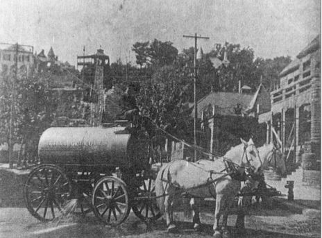
In 1865 John D. Bush proposed the laying out of Grand Avenue, commencing at Quigley lane opposite the brewery on Julien Avenue and extending along the ridge road until its intersection with the MILITARY ROAD on the top of Whiskey hill. In November, 1865, so unclean had the streets become, the citizens turned out en masse, formed a brigade, and cleaned them.
Over time, Dubuque, like other cities, changed street names. Many changes were made in 1921 at the suggestion of Ossian E. CARR, Dubuque's first City Manager. Among those that have been changed are the following:
| Original Name | New Name | Date of Change |
|---|---|---|
| Adams Avenue | Prescott Street | 1921 |
| Adams Street | Sac Street | 1921 |
| Alma Street | Montrose | |
| Altman Avenue | St. Joseph Street | 1921 |
| Anne Place | West 18th Street | |
| Arch Street | Seminary Street | 1921 |
| Aspen | Linden | |
| Audubon | Grandview | |
| Austin Place | Raymond Place | |
| Blocklinger Lane | West 24th Street | 1921 |
| Bluff Street | Providence | |
| Bluff | High Bluff | |
| Boundary Street | Grandview Avenue | 1871 |
| Brad Street | Booth | |
| Broad Street | Mt. Pleasant | |
| Brugh | Schiller | |
| Cardiff Street | Summit Street | 1921 |
| Cascade Road | Fremont | |
| Centre Street | Asbury | |
| Center Street | Finley Street | 1921 |
| Church | 6th | |
| Clay Street | Central Avenue (1st to 18th) | 1921 |
| Clifford Street | Eighth Street | 1921 |
| Clifford | Foye Street | |
| Clifton Street | Altman Avenue | 1921 |
| Columbia | Lexington | |
| Cora Street | South Hill St. | |
| Couler Street | Central Avenue (18th to city limits) | 1921 |
| Delhi Street | University Avenue | 1921 |
| Division | Lincoln | |
| Dubuque Street | Sumner | |
| Eagle Point Street | 20th Street | |
| Eagle Street Extension | Lindberg Terrace | |
| East Street | McCormick Street | 1921 |
| East | Glen Oak | |
| Eleanor Street | Indian Ridge | |
| Edith Street | Roland Street | 1921 |
| Empley's Lane | Thomas Street | 1921 |
| Exchange Street | South Hill | |
| Fink Street | Jansen Street | 1921 |
| Forrest Street | Florence | |
| Franklin Street | West 16th Street | 1921 |
| Franklin | Fulton | |
| Franklin | Edison | |
| Fremont Avenue | Wartburg Avenue | circa 1889 |
| Fremont Avenue | Wartburg Place | 1921 |
| Front Street | Peosta | 1938 |
| Grandview Heights | Plymouth Court | |
| Grant Avenue | Wilson Street | 1921 |
| Grove Street | Greeley Street | 1921 |
| Hales Mill | Asbury | |
| Hall Street | Auburn Street | 1921 |
| Harrison | Monroe | |
| Hart Street | West 23rd | 1921 |
| Hazel Street | Sunnyview | |
| Herron Street | South Locust Street | 1921 |
| High Street | Rhomberg | |
| High Street | Highland Pl. | |
| Iowa Street Extension | Shelby Street | |
| James Street | Huff | |
| Jefferson Avenue | Carter Road | |
| John Street | Simpson | |
| Julien Avenue | Lorimer Avenue | 1858 |
| Julien Avenue | University Avenue | 1940 |
| Julien | Primrose | |
| Karrick Street | Finley Street | 1921 |
| Kerrigan Road | 1956 | |
| Klingenberg Street | Hennepin Street | 1921 |
| Lake Street | Garfield | |
| Leibnitz Street | Lowell Street | 1921 |
| Lemon | Viola | |
| Lenox Avenue | Van Buren | |
| Linden Boulevard | Logan Street | 1921 |
| Logan | Belmont | |
| Lorimier Avenue | Julien Avenue | 1859 |
| Louisa Street | Algona Street | 1921 |
| Main Street | Front Street | |
| Malady | South Booth | |
| Maple Street | Morton Street | 1921 |
| Martha Ann | Martha | |
| McCabe | Broadway | |
| Middle Avenue | Farley Street | 1921 |
| Mineral Street | West Locust | |
| Millville Street | 32nd Street | 1921 |
| Military Street | Rockdale Road | |
| Monroe | Harlan | |
| Mount Carmel Avenue | South Locust Street | 1921 |
| National Street | Delhi | |
| North Cascade Road | Fremont Avenue | 1921 |
| North Street | Hale | 1921 |
| North 1st Street | Kimball Street | 1921 |
| North Iowa Street | Shelby Street | |
| North Main Street | Main Street | 1921 |
| O'Neill Street | Langworthy | 1921 |
| Orange | Washington | 1921 |
| Park Avenue | Randall Place | 1921 |
| Park Street | Asbury Road | |
| Park Hill | West 28th | 1921 |
| Park Way Avenue | Park Street | 1921 |
| Peru Road | 32nd Street | 1921 |
| Pine Street | Caledonia | |
| Pine Street | Pinard | |
| Pine Street | Poe Street | 1921 |
| Planke Road | Couler | |
| Pleasant View Avenue | Lexington Street | 1921 |
| Rebecca Street | Fairview Place | |
| Reed Avenue | Marshall Street | 1921 |
| Riga Street | Algona Street | 1921 |
| Rosedale Avenue | Auburn Street | 1921 |
| Russell Street | Rowan Street | 1921 |
| Sanford Street | East 24th | 1921 |
| Seminary Street | Clarke Drive | 1955 |
| Seminary Street (from 17th to 18th) | Heeb Street | 1921 |
| Shields | Pine | |
| South Dodge Street | Bryant Street | 1921 |
| South Street | Lombard | |
| Spring | North Booth | |
| State | National | |
| Stewart Street | Southern | |
| Thomas Street | West 16th Street | 1921 |
| Union Avenue | Kirkwood Street | 1921 |
| Valley | Dillon Street | |
| Vine Street | Burns Street | 1921 |
| Walnut | Karrick | |
| Wall | Wallace | |
| Wabash Avenue | Seward Street | 1921 |
| Warren | Putnam | |
| Wartburg Avenue | Fremont Avenue | 1920 |
| Washington Street | O'Hagen Street | |
| West Street | Needham Place | |
| West 4th Street | Melrose Street | 1921 |
| West 14th Street | Loras Avenue | 1940 |
| West Main Street | Shields Street | 1921 |
| West Eagle Point Avenue | Kaufmann | |
| West Seminary | Ungs Street | |
| Whelan | Bradley | |
| Wilde Street | Mt. Loretta | |
| Willow | Rosedale Street | 1921 |
| 1st Avenue | Decatur | 1921 |
| 2nd Avenue | Hamilton | 1921 |
| 3rd Avenue | Whittier | 1921 |
| 4th Avenue | Emerson | 1921 |
| 5th Avenue (west of Linwood Cemetery) | Edith Street | 1921 |
| 5th Avenue (east of Linwood Cemetery) | Roosevelt Street | 1921 |
| 6th Avenue | Stanton | 1921 |
| 7th Avenue | Shiras Avenue | 1921 |
| 8th Avenue | Farragut | 1921 |
| 9th Avenue | Hawthorne | 1921 |
| 10th Avenue | Sumner | 1921 |
The name Whiskey Hill was used colloquially to refer to Southern Avenue through the late 19th and early 20th centuries, but never appeared on any printed map or street sign. (1)
In 2014 Dubuque motorists noticed a new type of signal added to two traffic lights on Ninth Street as part of recent construction projects. The flashing yellow left-turn arrow signal was a new traffic management tool aimed at keeping traffic moving, increasing safety, and reducing fuel consumption. (2)
The new signals were installed at the intersections of Ninth and Locust and Ninth and White streets in Dubuque and were being added to intersections across Iowa. The new signal featured a flashing yellow left-turn arrow, in addition to a red, green and steady yellow arrow. The flashing yellow arrow replaced the circular green signal used in the traditional left-turn signal configuration to indicate the need for left-turning vehicles to yield to oncoming traffic and pedestrians. A flashing yellow arrow meant left turns were permitted, but motorists first had to yield to oncoming traffic and pedestrians, and then proceed with caution. The flashing yellow arrow did not replace the solid yellow arrow and its meaning; it did replace the green “ball” indication as a signal for a yielding left turn. (3)
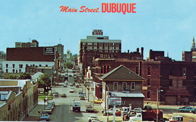
In November 2014 a new traffic control pavement marking was announced in the redesign of two downtown Dubuque streets. Dubuque motorists were reminded to note the change and stop where directed by the signage at the four intersections featuring diagonal crosshatch markings. The purpose of the markings was to force traffic to stop at a red traffic signal at a distance before the intersection, which allows truck traffic adequate space to safely make turns on to that street from the right of the intersection. (4)
White “Do Not Block” diagonal crosshatch markings were added to two intersections on Ninth Street and two intersections on Eleventh Street as part of the conversion from one-way to two-way streets. The intersections were for westbound traffic at the intersections of Ninth Street and White Street, Ninth Street and Central Avenue, Eleventh Street and White Street, and Eleventh Street and Central Avenue. Each intersection featured signage stating “Stop Here on Red. (5)
Source:
1. News Release. City of Dubuque. September 8, 2014. Online: http://www.cityofdubuque.org/newsreleases
2. Ibid.
3. Ibid.
4. News Release. City of Dubuque. November 25, 2014. Online: http://www.cityofdubuque.org/newsreleases
5. Ibid.
- Lorimer Avenue." Dubuque Times Journal. Dubuque, IA, May 4, 1858.
- Map of the City of Dubuque.Iowa Publishing Company. Davenport, Iowa, 1906.
- "Ordinance Changing Street Names is Passed by Council at Last Meeting." Dubuque Times Journal, Dubuque, IA, March 27, 1921.
- Oldt, Franklin T., History of Dubuque County, Iowa. Chicago: Goodspeed Historical Association
- Research by John Klauer; 1918 Dubuque City Directory
- Stessman, James T. "History of the Names of Streets of Dubuque." April 26, 1954. On file at Carnegie-Stout Public Library.
- "Folks on Seminary Street Have New Address; It's Clarke Drive." Telegraph Herald, Dubuque, IA, September 7, 1955.
- "Whiskey Label Sticks to Steep Hill." Telegraph Herald, Dubuque, IA, March 16, 1999.


